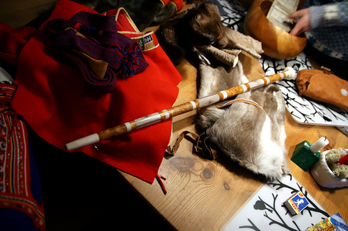
SSILA: studying the indigenous languages of the Americas
January 24, 2009 at 4:21 pm | Posted in Alaska, Language, Organization | Leave a commentA arrived to this site via Talking Alaska. They were announcing the SSILA 2009 Annual Meeting, with the following topics:
- Acoustic correlates of stress in the Inland dialect of Dena’ina Athabascan (Siri Tuttle, University of Alaska, Fairbanks)
- The phonetics of tone in two dialects of Dane-zaa (Julia Colleen Miller, University of Washington)
- A H+L% boundary tone in Athabaskan (Sharon Hargus, University of Washington)
- Landscape and landscape at the intersection of Athabascan and Eskimo (Gary Holton, University of Alaska Fairbanks)
- The morphosyntax of Navajo comparatives and the degree argument (Elizabeth BogalAllbritten, Swarthmore)
- Aspiration as phonation: An acoustic analysis of aspirated affricates in the Dene languages (Joyce McDonough, University of Rochester; Jordan Lachler, Sealaska Heritage Institute; Sally Rice, University of Alberta)
- Coordination in Pribil of Islands Aleut (Anna Berge, University of Alaska Fairbanks)
- A contrastive feature account of Inuit ‘strong’ and ‘weak’ /i/ (Richard Compton and B. Elan Dresher, University of Toronto
- Navajo degree constructions and the decompositional analysis of gradable predicates (Elizabeth BogalAllbritten, Swarthmore)
After reading that, I keep looking for more information:
The Society for the Study of the Indigenous Languages of the Americas (SSILA)
The Society for the Study of the Indigenous Languages of the Americas (SSILA) was founded in December 1981 as the international scholarly organization representing American Indian linguistics, and was incorporated in 1997. Membership in SSILA is open to all those who are interested in the scientific study of the languages of the native peoples of North, Central and South America. The Society has approximately 900 members, more than a third of them residing outside the United States.
All members receive the SSILA Newsletter, a quarterly publication that contains news, announcements, notices of recent publications, current journal contents, a listing of recent dissertations, and several other regular features. (The Newsletter is sent at the airmail rate to all members residing outside the United States, at no additional charge.) If you would like to purchase previous volumes of the SSILA Newsletter, most are still avaliable for US $3.50 per issue. A “SSILA Bulletin” with late-breaking news, job openings, etc.,is also e-mailed to all members (and to others on request) every two to fourweeks. The “SSILA Bulletin” is archived on this website in pdf format.
Other activities and benefits of the Society include:
- SSILA holds an annual winter meeting, featuring several topical sessions on various aspects of American Indian linguistics, usually meeting jointly with the Linguistic Society of America. We will next meet in Chicago, Illinois in January, 2008.
- The Mary R. Haas Book Award is presented annually to an unpublished monograph that the Society judges to be a significant contribution to our knowledge of American indigenous languages. Manuscripts receiving the Haas Award are eligible for publication under the Society’s sponsorship.
- A Membership Directory is published yearly in February, and includes an index of the language specializations of the Society’s members, as well as postal and e-mail addresses. The Directory is available to members for US $3.50 (or $5.00 Canadian) in addition to basic dues. A searchable web version of the Membership Directory, with postal and e-mail addresses, is kept current. The membership directory is available only to members.
- Mouton de Gruyter regularly offers substantial discounts to SSILA members on its publications in American Indian linguistics and allied topics.
- The SSILA Bulletin with late-breaking news, job openings, etc., is posted regularly (at least once a month, and sometimes more frequently) on the Internet. Back issues are archived at the SSILA website.
Do not miss the bulletin, the newsletter and the links pages! And if you find it interesting enough, you may decide to apply as a member here.
Travel time to major cities
January 15, 2009 at 12:57 am | Posted in Maps, North Pole, Research | Leave a commentThis information arrived to me via my friend Xarxes. This map shows how from most of the planet it tajes less than 48 hours to reach a major city. They say that only 10% of the land area is remote – more than 48 hours from a large city, and also that 95% of the people live on just 10% of the land. We see that the territories around the arctic circle, maybe except Scandinavia, are a notable exception. That should be taken into account and respected.
Travel Time to Major Cities
Background
The world is shrinking. Cheap flights, large scale commercial shipping and expanding road networks all mean that we are better connected to everywhere else than ever before. But global travel and international trade and just two of the forces that have reshaped our world. A new map of Travel Time to Major Cities – developed by the European Commission and the World Bank – captures this connectivity and the concentration of economic activity and also highlights that there is little wilderness left. The map shows how accessible some parts of the world have become whilst other regions have remained isolated. Accessibility – whether it is to markets, schools, hospitals or water – is a precondition for the satisfaction of almost any economic need. Furthermore, accessibility is relevant at all levels, from local development to global trade and this map fills an important gap in our understanding of the spatial patterns of economic, physical and social connectivity.
These web pages describe the global map of accessibility, the input GIS data and a description of the underlying model that were developed by Andrew Nelson in the GEM unit in collaboration with the World Bank’s Development Research Group between October 2007 and May 2008.
What these data are and what they are not
Accessibility maps are made for a specific purpose and they cannot be used as a generic dataset to represent “the” accessibility for a given study area. The data described and presented here were used to create an urban/rural population gradient around large cities of 50,000 or more people. The assumptions made in the generation of this accessibility map can be found in the description and data sources links on the left. If these assumptions sound reasonable for your requirements then the data are available for download. If, however, the assumptions do not match your requirements then you can use the information in these pages as well as the software and external links to create your own accessibility model.
Why was this map made?This map was made for the World Bank’s World Development Report 2009 Reshaping Economic Geography. The message of the report can be summarised as: Concentration & density. 95% of the people live on just 10% of the land “As economies grow from low to high income, production becomes more concentrated spatially. Some places—cities, coastal areas, and connected countries—are favored by producers. … The way to get both the immediate benefits of concentration of production and the long-term benefits of a convergence in living standards is economic integration.” (WDR 2009, Overview). For measuring the concentration of economic activity, instead of using binary distinctions of rural versus urban, the report takes advantage of global accessibility measures which can be combined with data on population density to create a much finer typology which is termed the Agglomeration Index (AI). The global map of travel time to major cities (cities of 50,000 or more people in year 2000) is a useful dataset in its own right, but it is also a component of the AI.

This map has been created by the World Bank’s World Development Report 2009 Reshaping Economic Geography and it is published by the Global Environment Monitoring (European Comission).
Recent Comments
Atka Kevlarsjal on Polar People xarxes on Polar People Atka Kevlarsjal on The Red Book of Russian People… Atka Kevlarsjal on The Red Book of Russian People… Alvaro on The Red Book of Russian People…  fonent el gel (versió en català)
- Mapes tàctils de Grenlàndia
- Tikigaq a Point Hope, Alaska
- Xerrant en Inuktitut
- Les mans fora de l’àrtic
- Segon pas: Kalaallit Nunaat
- Veus de la tundra i la taiga
- Talking Alaska
- Alaska Native Language Center
- Connexió entre llengües de Sibèria i Alaska: noves recerques
- Survival International: els pobles de Sibèria
Create a free website or blog at WordPress.com.
Entries and comments feeds.
